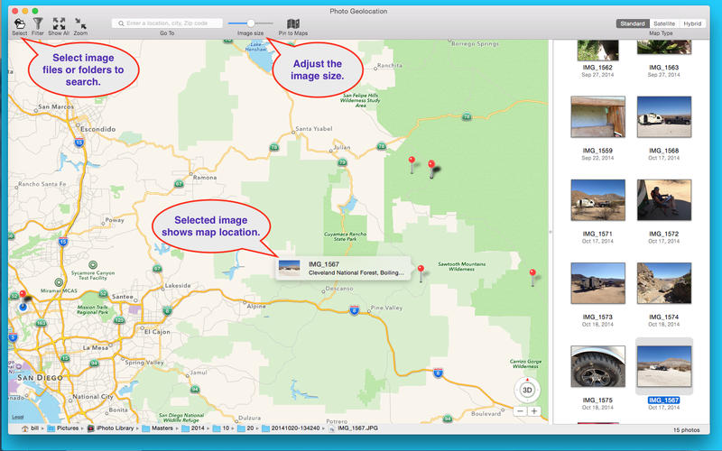


Photo Geolocation scans image fils and folders (and sub-folders within) you choose for image files that contain geolocation data and displays the images as well as their location on a map.
Every wonder where you took a picture? Now you can easily scan your geotagged photos and find the location. Suppose you take a lot of photos with your iPhone or other camera that geotags the photos. You know you should, but you don’t bother giving the photos names or put them in a nicely labeled album. Instead you just feed them into iPhoto or some other folder. Eventually you end up with a lot of unnamed photos, over 10,000. Now someone says “let me see the photos of your Yellowstone trips.” You could search all 10,000 photos, somehow flagging the photos you think are from Yellowstone, but that might take some time. Instead you use Photo Geolocation, set the filter map to Yellowstone, and within seconds all your photos of Yellowstone appear!
Or use it to simply browse your photos!
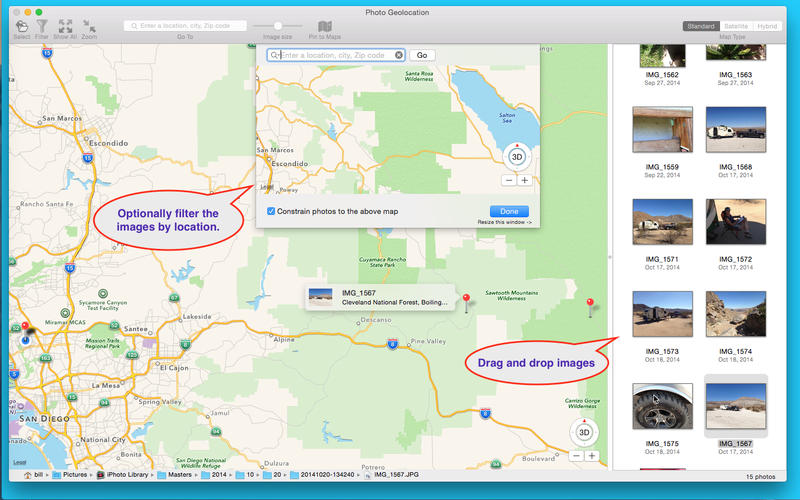
- Specify a location on the map to constrain the search area.
- Choose between Apple Maps or OpenStreet Maps.
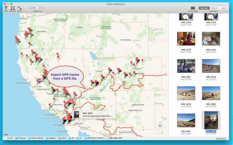
- Import GPX tracks from GPX files.
- Send the image location to Apple Maps.
- Works with RAW images as well as any other images that contain geolocation data.
- Click on a image to see its location on the map.
- Click on a map pin to select its associated image.
- Double-click an image to display it in Preview.
Note: you cannot change the geolocation of an image with this app. To add or modify the geolocation please see our app Photo GeoTag available from the Mac App Store.